BAGUIO CITY walk: Explore famous "Summer Capital of the Philippines"
5.8 هزار بار بازدید -
7 ماه پیش
-
For more videos, pls click
For more videos, pls click the link below. SUBSCRIBE, like, share & comment. Tnx!
PHILIPPINES WALK TOUR
■ BAGUIO CITY:
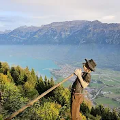
Baguio is a 1st class highly urbanized city in the Cordillera Administrative Region, Philippines. It is known as the "Summer Capital of the Philippines", owing to its cool climate since the city is located approximately 1,470m above mean sea level, often cited as 1,540m in the Luzon tropical pine forests ecoregion, which also makes it conducive for the growth of mossy plants, orchids and pine trees, to which it attributes its other moniker as the "City of Pines".
Baguio was established as a hill station by the United States in 1900 at the site of an Ibaloi village known as Kafagway. It was the United States' only hill station in Asia.
Baguio is classified as a highly urbanized city (HUC). It is geographically located within Benguet, serving as the provincial capital from 1901 to 1916, but has since been administered independently from the province following its conversion into a chartered city. The city is the center of business, commerce, and education in northern Luzon, as well as the seat of government of the Cordillera Administrative Region. According to the 2020 census, Baguio has a population of 366,358.
GEOGRAPHY:
Baguio is located some 1,400m above sea level, nestled within the Cordillera Central mountain range in northern Luzon. Enclosed by the province of Benguet, the city covers a small area of 57.5km2. Most of the developed part of the city is built on uneven, hilly terrain of the northern section. When Daniel Burnham drew plans for the city, he made the City Hall a reference point where the city limits extend 8.2km from east to west and 7.2km from north to south.
CLIMATE:
Under the Köppen climate classification, Baguio features a tropical monsoon climate (Köppen climate classification: Am). The city is known for its mild climate owing to its high elevation. The temperature in the city is usually about 7 to 8°C cooler than the lowland temperature. Average temperature ranges from 15 to 23°C, with the lowest temperatures between November and February. The lowest recorded temperature was 6.3°C on January 18, 1961; in contrast, the all-time high of 30.4°C was recorded on March 15, 1988, during the 1988 El Niño season. The temperature seldom exceeds 26°C even during the warmest part of the year.
PRECIPITATION:
Like many other cities with a subtropical highland climate, Baguio receives noticeably less precipitation during its dry season. However, the city has an extraordinary amount of precipitation during the rainy season from June to October. The city averages over 3,914mm of rainfall annually, the highest in the country.
POLLUTION:
Baguio suffers from air pollution and is one of the cities with the dirtiest air in the Philippines, according to a 2014 WHO report; a slight improvement in the city's air quality was cited in 2017 by the DENR's Environmental Management Bureau. In a 2018 WHO report, the city was listed as having the most polluted air among 8 other local cities (Cebu, Dagupan, Davao, Manila, San Carlos, Urdaneta and Zamboanga). Eco-vehicles and Euro 4 compliant vehicles have been tested whether or not they are suited for the city's steep slopes in line with efforts to modernize its Public Utility Vehicles (PUVs). PUVs, specifically jeepneys, have been pushed for its modernization, in line with President Duterte's PUV modernization initiative.
Another problem that plagues Baguio is its garbage and waste disposal. The city has been dumping its garbage in a landfill in Urdaneta City, but rising costs are putting a strain on the city's budget. In early 2018, the city government started using its garbage transfer station in the city outskirts near Marcos Highway, drawing protests from residents of the nearby town of Tuba, who cited the facility poses health hazards to their communities. As of 2019, the Philippine National Oil Company has offered to test a waste-to-energy technology as a possible solution to its garbage woes. Baguio's waste water treatment plant is also eyed for an expansion as it has been unable to fully cater to the city's needs; wastewater which the plant could not accommodate were dumped in the Balili River, leading to its high coliform levels—even higher than that of Manila Bay's.
■ WALK ROUTE:
Gov Pack Rd, Session Rd, Fr Carlu St, Baguio Cathedral, Alleyway, Assumption Rd, University of Baguio, Gen Luna Rd, Mabini St, Gen Luna Rd, Alleyway, E Jacinto St, Perfecto St, Malcolm Square, Magsaysay Ave, Lakandula St, Rajah Soliman St, Baguio Centermall, T. Alonzo St, New Lucban Rd, Lower Bonifacio St.
■ REFERENCE:
https://en.wikipedia.org/wiki/Baguio
https://www.google.com/maps/place/Bag...
#baguiocity #baguio #philippines
■ REMARKS:
Please don't forget to like, share, SUBSCRIBE and leave a comment to my channel and click "ON" the notification bell for the latest video updates. Thanks! 👍👀
PHILIPPINES WALK TOUR
■ BAGUIO CITY:
Baguio is a 1st class highly urbanized city in the Cordillera Administrative Region, Philippines. It is known as the "Summer Capital of the Philippines", owing to its cool climate since the city is located approximately 1,470m above mean sea level, often cited as 1,540m in the Luzon tropical pine forests ecoregion, which also makes it conducive for the growth of mossy plants, orchids and pine trees, to which it attributes its other moniker as the "City of Pines".
Baguio was established as a hill station by the United States in 1900 at the site of an Ibaloi village known as Kafagway. It was the United States' only hill station in Asia.
Baguio is classified as a highly urbanized city (HUC). It is geographically located within Benguet, serving as the provincial capital from 1901 to 1916, but has since been administered independently from the province following its conversion into a chartered city. The city is the center of business, commerce, and education in northern Luzon, as well as the seat of government of the Cordillera Administrative Region. According to the 2020 census, Baguio has a population of 366,358.
GEOGRAPHY:
Baguio is located some 1,400m above sea level, nestled within the Cordillera Central mountain range in northern Luzon. Enclosed by the province of Benguet, the city covers a small area of 57.5km2. Most of the developed part of the city is built on uneven, hilly terrain of the northern section. When Daniel Burnham drew plans for the city, he made the City Hall a reference point where the city limits extend 8.2km from east to west and 7.2km from north to south.
CLIMATE:
Under the Köppen climate classification, Baguio features a tropical monsoon climate (Köppen climate classification: Am). The city is known for its mild climate owing to its high elevation. The temperature in the city is usually about 7 to 8°C cooler than the lowland temperature. Average temperature ranges from 15 to 23°C, with the lowest temperatures between November and February. The lowest recorded temperature was 6.3°C on January 18, 1961; in contrast, the all-time high of 30.4°C was recorded on March 15, 1988, during the 1988 El Niño season. The temperature seldom exceeds 26°C even during the warmest part of the year.
PRECIPITATION:
Like many other cities with a subtropical highland climate, Baguio receives noticeably less precipitation during its dry season. However, the city has an extraordinary amount of precipitation during the rainy season from June to October. The city averages over 3,914mm of rainfall annually, the highest in the country.
POLLUTION:
Baguio suffers from air pollution and is one of the cities with the dirtiest air in the Philippines, according to a 2014 WHO report; a slight improvement in the city's air quality was cited in 2017 by the DENR's Environmental Management Bureau. In a 2018 WHO report, the city was listed as having the most polluted air among 8 other local cities (Cebu, Dagupan, Davao, Manila, San Carlos, Urdaneta and Zamboanga). Eco-vehicles and Euro 4 compliant vehicles have been tested whether or not they are suited for the city's steep slopes in line with efforts to modernize its Public Utility Vehicles (PUVs). PUVs, specifically jeepneys, have been pushed for its modernization, in line with President Duterte's PUV modernization initiative.
Another problem that plagues Baguio is its garbage and waste disposal. The city has been dumping its garbage in a landfill in Urdaneta City, but rising costs are putting a strain on the city's budget. In early 2018, the city government started using its garbage transfer station in the city outskirts near Marcos Highway, drawing protests from residents of the nearby town of Tuba, who cited the facility poses health hazards to their communities. As of 2019, the Philippine National Oil Company has offered to test a waste-to-energy technology as a possible solution to its garbage woes. Baguio's waste water treatment plant is also eyed for an expansion as it has been unable to fully cater to the city's needs; wastewater which the plant could not accommodate were dumped in the Balili River, leading to its high coliform levels—even higher than that of Manila Bay's.
■ WALK ROUTE:
Gov Pack Rd, Session Rd, Fr Carlu St, Baguio Cathedral, Alleyway, Assumption Rd, University of Baguio, Gen Luna Rd, Mabini St, Gen Luna Rd, Alleyway, E Jacinto St, Perfecto St, Malcolm Square, Magsaysay Ave, Lakandula St, Rajah Soliman St, Baguio Centermall, T. Alonzo St, New Lucban Rd, Lower Bonifacio St.
■ REFERENCE:
https://en.wikipedia.org/wiki/Baguio
https://www.google.com/maps/place/Bag...
#baguiocity #baguio #philippines
■ REMARKS:
Please don't forget to like, share, SUBSCRIBE and leave a comment to my channel and click "ON" the notification bell for the latest video updates. Thanks! 👍👀
7 ماه پیش
در تاریخ 1402/10/03 منتشر شده
است.
5,865
بـار بازدید شده