3-1 Astronomical and geodetic coordinates and their relations
183 بار بازدید -
2 هفته پیش
-
Based on our understanding of
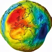
Based on our understanding of Earth's shape, two coordinate systems are used to position points on its surface. When considering the physical shape, or geoid, the coordinate system is known as the astronomical coordinate system. When the mathematical shape, or ellipsoid, is used, it is referred to as the geodetic coordinate system. In both systems, four geometric quantities—longitude, latitude, height, and azimuth—are defined to determine the position of points. Since the reference for heights (the vertical datum) is the geoid, and the datum for horizontal coordinates is the ellipsoid, it is essential to understand the differences between the corresponding coordinates in each system.
This lecture defines longitude, latitude, height, and azimuth in both the astronomical and geodetic systems and presents the mathematical relationships between the corresponding coordinates. While mathematical proofs are not included, the focus is on explaining the geometry of the coordinates and their conversions in a clear and educational manner.
For more detailed information, refer to the following resources:
- Vaníček, P. (1975). Physical Geodesy, Lecture Note 43, Department of Geodesy and Geomatics Engineering, University of New Brunswick, Canada.
file:///C:/Users/profm/Downloads/LN43.pdf
- Jekeli, C. (2016). Geometric Reference Systems in Geodesy, Lecture Note, Division of Geodetic Science, Ohio State University, USA.
https://kb.osu.edu/server/api/core/bi...
2 هفته پیش
در تاریخ 1403/06/13 منتشر شده
است.
183
بـار بازدید شده