How to create 3D Model of DEM image using QGIS
58.6 هزار بار بازدید -
3 سال پیش
-
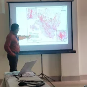
This tutorial gives you the
This tutorial gives you the basic idea that how to create 3D model from DEM image using QGIS. 3D modelling is a important Gis technique for analysis of different planning and development processes. It is used in watershed development, 3D analysis of an area as well as river basin etc.
#3D_modelling
#3D_topography
#Software
#GIS
#GIS_Software
#QGIS
Link of Image to image georeferencing: How to do Image to Image Georeferenci...
Link of Raster image georeferencing: How to do Georeference a Raster map i...
Link of Raster image digitization: How to do Digitization with QGIS 2020...
Choropleth Map Preparation using QGIS 2020: How to prepare a Choropleth Map Prepa...
NDVI Calculation: How to do NDVI Calculation in QGIS II...
Follow the Link for more videos:
Video
How to Geo Referencing of Topographic...
How to create Thiessen Polygons in QG...
How to merge overlapped Landsat Band...
How to Create River and City Points M...
How to Create Multiple Buffer Zone in...
Change Detection Analysis of Land use...
Change Detection Analysis of Land use...
How to download Land use and Land cov...
Accuracy assessment of Landuse and La...
How to download District River, Road,...
How to download World Shape file and ...
How to create 3D Model of DEM image u...
Land Use Land Cover Map of Landsat 8 ...
How to create DEM from Google Earth I...
How to create DEM (Elevation Map) an...
How to create Contour line and DEM (E...
3 سال پیش
در تاریخ 1400/04/23 منتشر شده
است.
58,666
بـار بازدید شده