Philippines Colorful Digital Elevation DEM Model Using GEE and Processing in ArcMap 10.8
126 بار بازدید -
6 ماه پیش
-
In this video, we dive
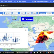
In this video, we dive into the exciting world of geospatial analysis as we demonstrate how to craft a visually stunning Digital Elevation Model (DEM) of the Philippines. Utilizing the power of Google Earth Engine (GEE) and Processing in ArcMap 10.8, we showcase step-by-step procedures to transform raw elevation data into a vibrant representation of the Philippine landscape.
Starting with data acquisition, we guide you through accessing elevation data sources and preparing them for processing. Then, leveraging GEE's robust functionalities, we demonstrate how to extract, manipulate, and enhance the elevation data to generate a detailed DEM.
Next, we transition to ArcMap 10.8, where we employ advanced processing techniques to further refine the DEM. Through intricate analysis and visualization tools, we add depth and richness to the elevation model, bringing out the unique topographical features of the Philippines.
But the journey doesn't end there. We delve into the creative aspect of cartography, illustrating how to apply a spectrum of vibrant colors to the DEM, transforming it into a captivating representation of the Philippine terrain. From lush green valleys to towering mountain ranges, every contour of the landscape comes to life in this colorful rendition.
Whether you're a GIS enthusiast, a researcher, or a student exploring the wonders of geospatial analysis, this video offers invaluable insights and practical techniques for creating captivating Digital Elevation Models using GEE and ArcMap. Join us on this immersive journey and unlock the potential of geospatial data visualization in depicting the beauty of the Philippine archipelago.
6 ماه پیش
در تاریخ 1402/11/06 منتشر شده
است.
126
بـار بازدید شده